Examples of Our Work
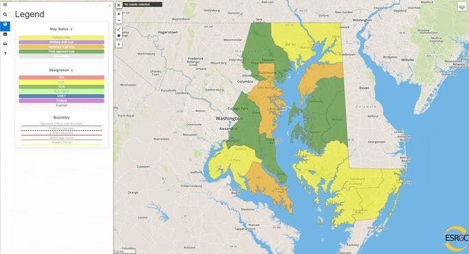
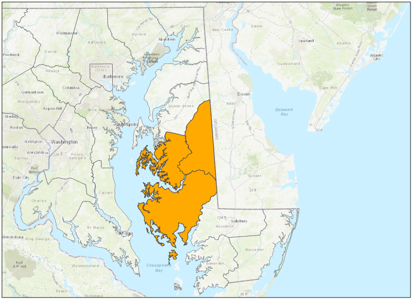
Critical Area Commission: Critical Area Mapping Manager
Ongoing
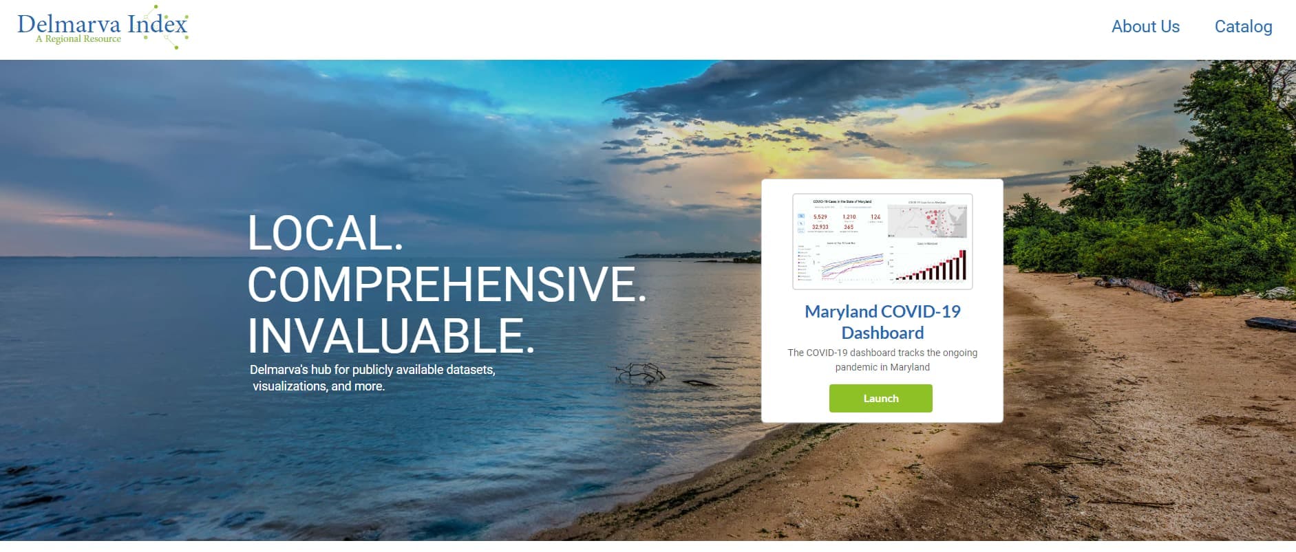
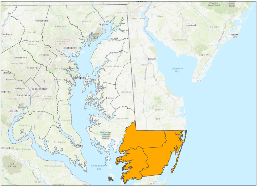
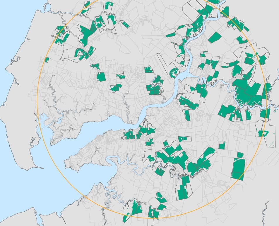
Delmarva Index
Ongoing
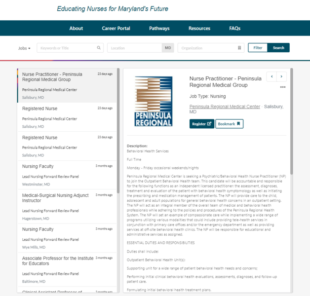
Lead Nursing Forward Website and Career Portal
Ongoing

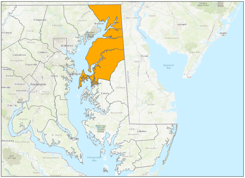
LiDAR Support for DoIT’s Geographic Info Office
Ongoing
MDSHA Climate Change Adaptation Planning
Ongoing
MSRC RMPIF - GIS Circuit Rider
Ongoing
TCC RMPIF - GIS Circuit Rider
Ongoing
USRC RMPIF - GIS Circuit Rider
Ongoing
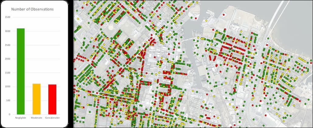
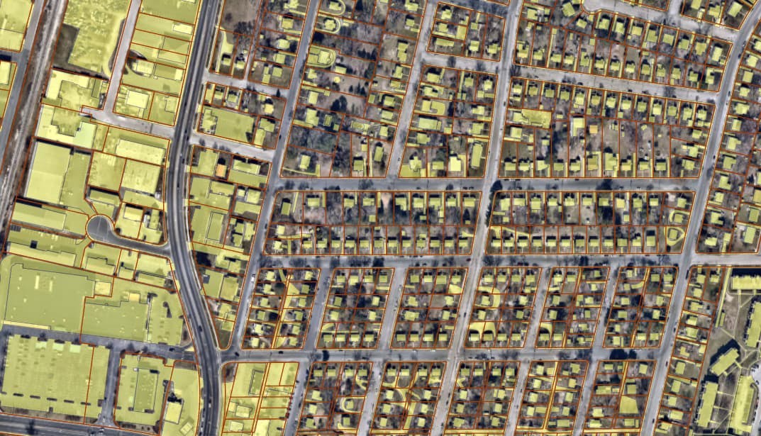
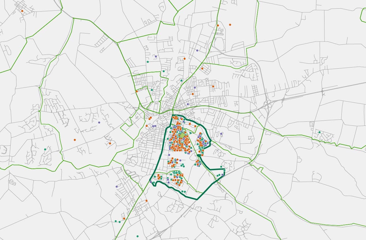
Housing Quality Study - City of Salisbury
September 2024

Maryland Forestry and Wood Product Resources
October 2021

Maryland's Forestry Industry StoryMap
May 2021
MSRC RMPIF - 500 year building heights
July 2020
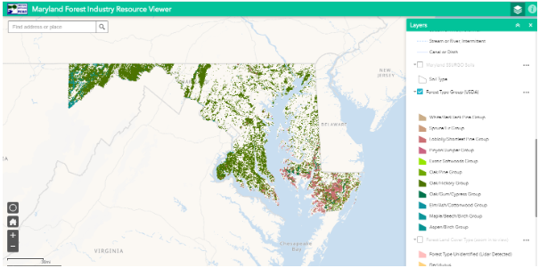
Maryland Forest Inventory Resource Viewer
May 2020
MSRC RMPIF - Caroline County Building Footprints
May 2020
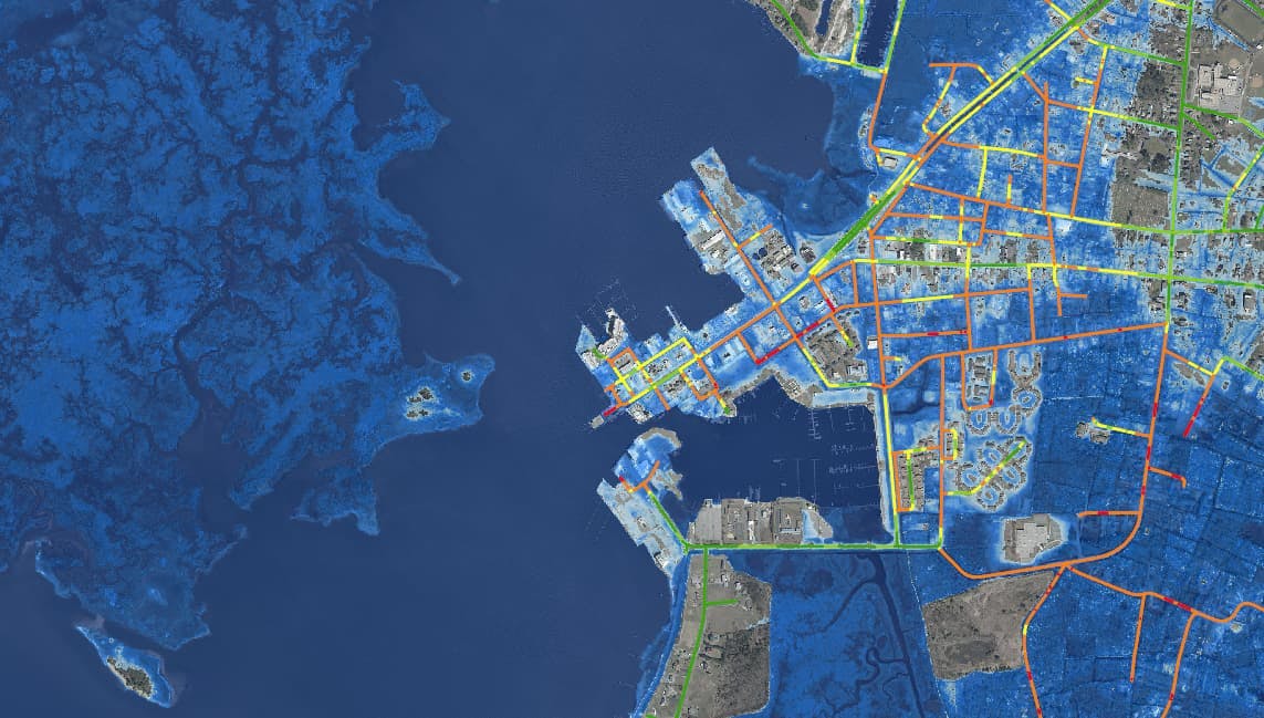
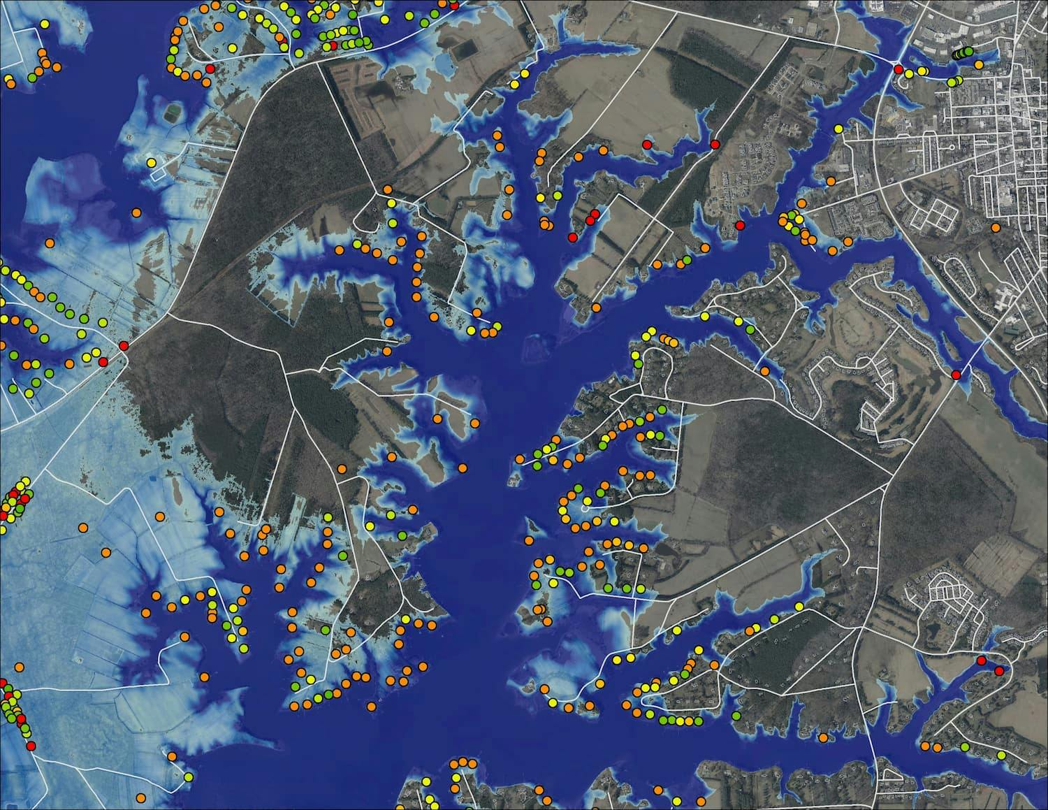
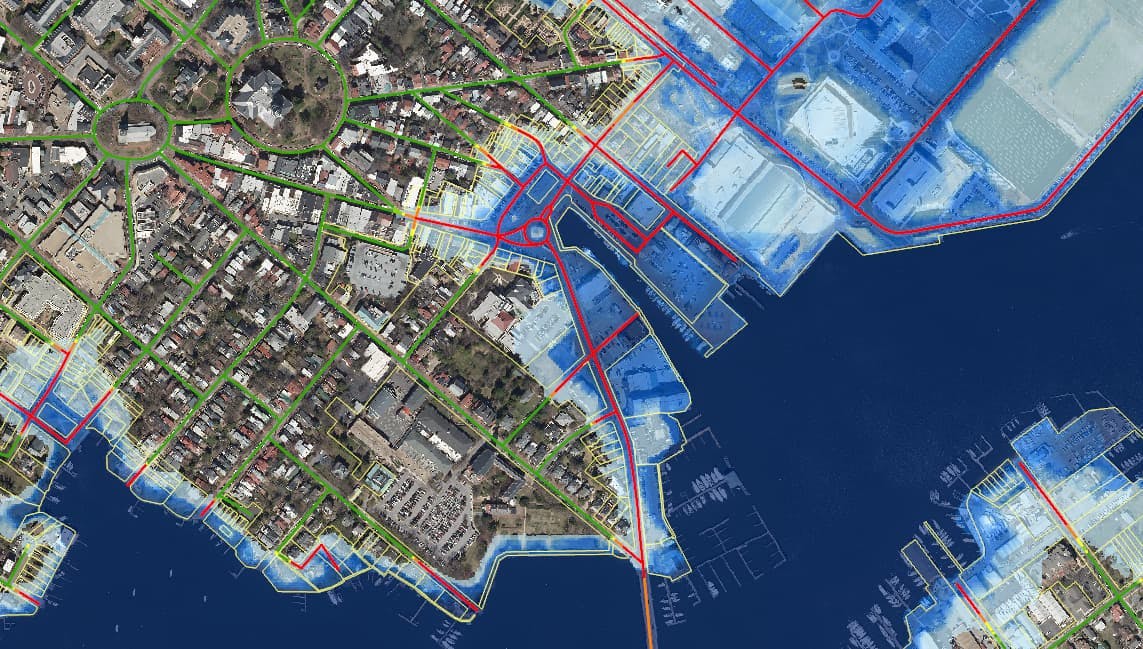
Mapping Current and Future Nuisance Flooding Inundation
May 2020
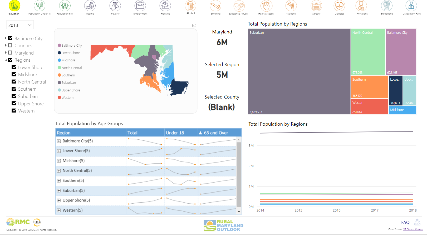
Rural Maryland Outlook
May 2020
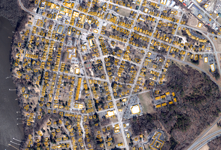
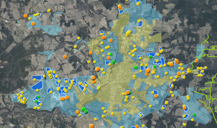
City of Salisbury Impervious Surface
April 2020
Wicomico County Board of Education Mapping Assistance
April 2020
Wicomico County PW MS4 Maintenance
March 2020
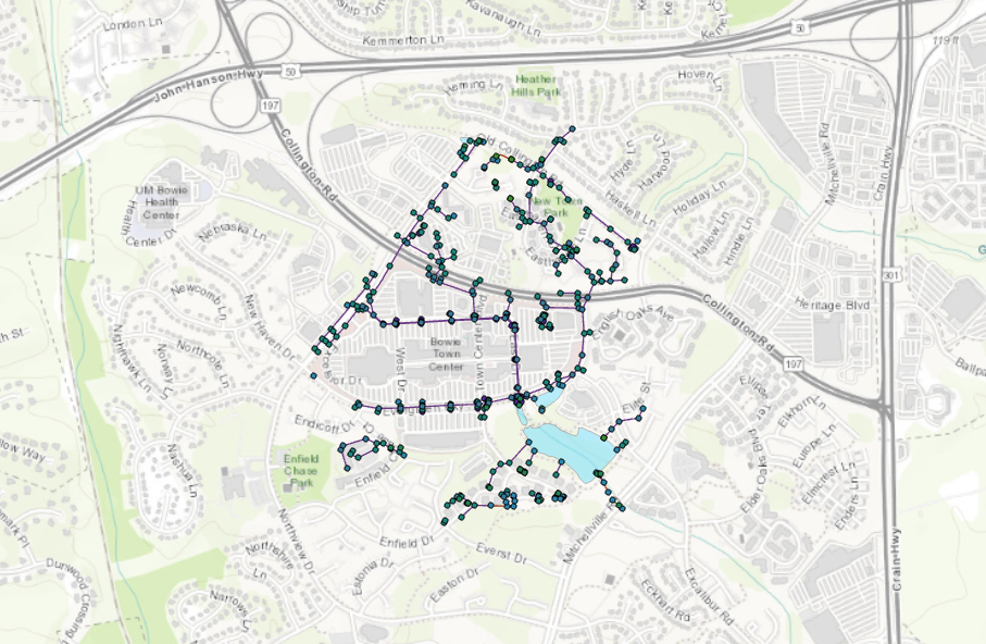
MS4 Stormwater Pilot for Bowie, Maryland
January 2020
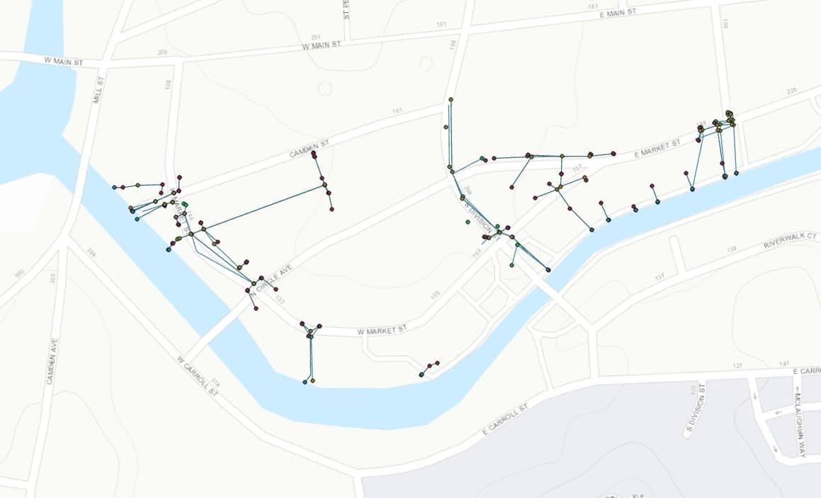
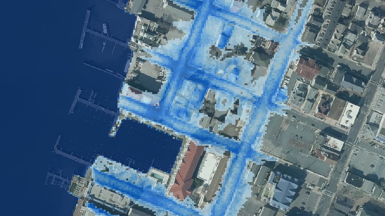
City of Salisbury Stormwater Field Review
October 2019
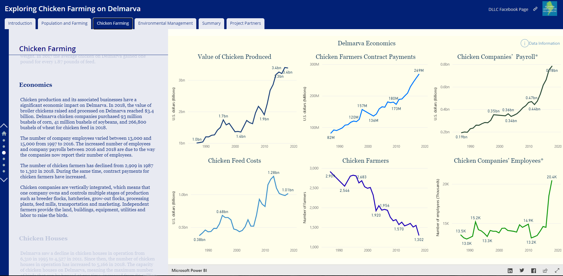
Exploring Chicken Farming on Delmarva
October 2019
Wicomico County Site Selection for Dredge Materials
October 2019
Wicomico County MS4 BMP drainage areas
September 2019
Somerset County Housing Study
July 2019
Hurricane Florence Storm Surge Heights in the Chesapeake Bay
May 2019
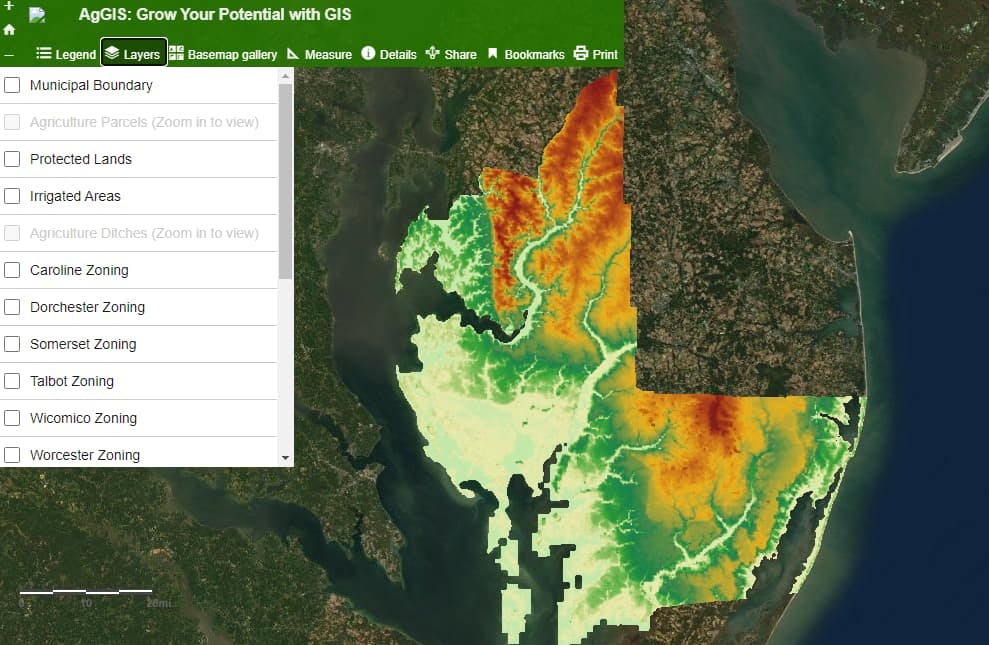
AgGIS Web Map
December 2017