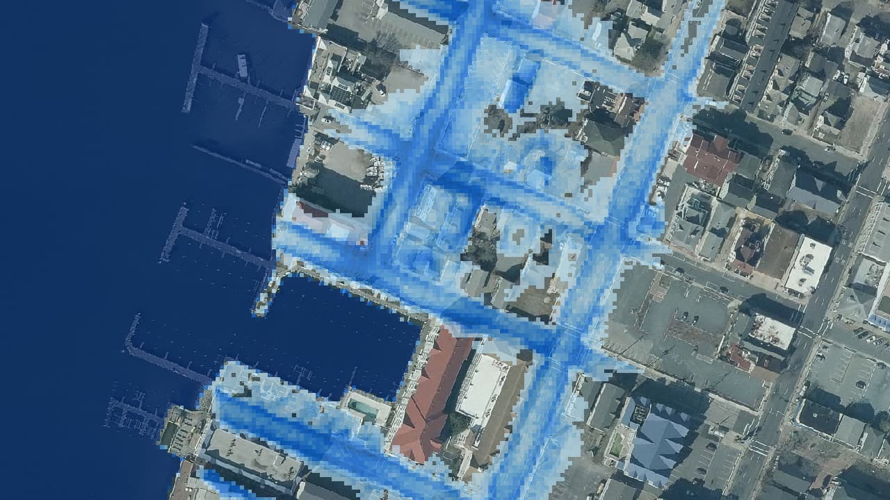
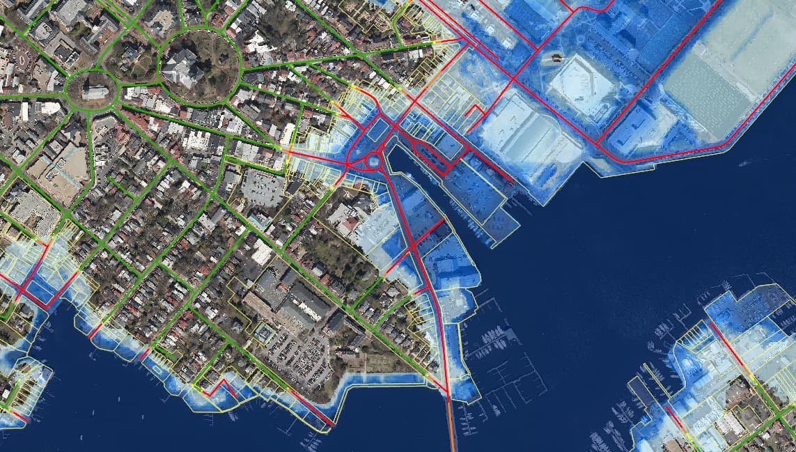
Hurricane Florence Storm Surge Heights in the Chesapeake Bay
In light of the significant damage in the state of North Carolina caused by the storm surge from Hurricane Florence on September 14, 2018, concerns about the vulnerability of coastal communities on the Atlantic coast of Maryland and in Maryland’s portion of the Chesapeake Bay have come into focus. This project seeks to replicate the storm surge heights seen with Hurricane Florence, to determine a what-if scenario in coastal Maryland.
The data may be used and redistributed for free but is not intended for legal use, since it likely contains inaccuracies. The User assumes the entire risk associated with its use of these data and bears all responsibility in determining whether these data are fit for the User's intended use. The information contained in these data is dynamic and will change over time. The data are not better than the original sources from which they were derived, and both scale and accuracy may vary across the data set. These data may not have the accuracy, resolution, completeness, timeliness, or other characteristics appropriate for applications that potential users of the data may contemplate. The User is encouraged to carefully consider the content of the metadata file associated with these data. These data are neither legal documents nor land surveys, and must not be used as such. Maryland State Highway Administration and the Eastern Shore Regional GIS Cooperative should be cited as the data source in any products derived from these data. Any Users wishing to modify the data should describe the types of modifications they have performed. The User should not misrepresent the data, nor imply that changes made were approved or endorsed by Maryland State Highway Administration and/or the Eastern Shore Regional GIS Cooperative. Neither the Maryland State Highway Administration, Eastern Shore Regional GIS Cooperative, nor the State of Maryland, nor any of their employees or contractors, makes any warranty, express or implied, including warranties of merchantability and fitness for a particular purpose, or assumes any legal liability for the accuracy, completeness, or usefulness, of this information.
Date Completed
May 2019
Partners
- Maryland Department of Transportation State Highway Administration
Solutions
- Data Development
- Flood Modeling
- GIS Analysis
- Web Services
- Cartography